Dover atravè tan
Ansyen kat Dover
Ou ka gade kat sa yo epi itilize yo gratis. Chwazi youn pou louvri tout kat la nan Bibliyotèk Kongrè a oswa nan Sèvis Jewolojik Etazini.
Kat pa ane
- 1859 Map of Kent County, Delaware, from actual surveys
- 1885 Sanborn fire insurance map of Dover, April 1885
- 1891 Sanborn fire insurance map of Dover, 1891
- 1897 Sanborn fire insurance map of Dover, 1897
- 1899 USGS topographic map, Dover quadrangle, 1899
- 1904 Sanborn fire insurance map of Dover, September 1904
- 1906 USGS topographic map, Dover quadrangle, 1906
- 1910 Sanborn fire insurance map of Dover, 1910
- 1919 Sanborn fire insurance map of Dover, 1919
- 1920 USGS topographic map, Dover quadrangle, 1920
- 1929 Sanborn fire insurance map of Dover, August 1929
- 1950 Sanborn fire insurance map of Dover, August 1950
- 1956 USGS topographic map, Dover quadrangle, 1956
- 1984 USGS topographic map, Dover quadrangle, 1984
- 1993 USGS topographic map, Dover quadrangle, 1993
Kat konte a
 1859 Map of Kent County, Delaware, from actual surveysJ. H. French and others, via the Library of Congress. Library of Congress: public domain, free to use and reuse. Credit: Library of Congress, Geography and Map Division.Louvri tout kat la
Kat asirans kont dife
Kat Sanborn yo te desine chak bilding, lari pa lari, pou konpayi asirans kont dife.
 1885 Sanborn fire insurance map of Dover, April 1885Sanborn Map Company, via the Library of Congress. Library of Congress: public domain, free to use and reuse. Credit: Library of Congress, Geography and Map Division.Louvri tout kat la
 1891 Sanborn fire insurance map of Dover, 1891Sanborn Map Company, via the Library of Congress. Library of Congress: public domain, free to use and reuse. Credit: Library of Congress, Geography and Map Division.Louvri tout kat la
 1897 Sanborn fire insurance map of Dover, 1897Sanborn Map Company, via the Library of Congress. Library of Congress: public domain, free to use and reuse. Credit: Library of Congress, Geography and Map Division.Louvri tout kat la
 1904 Sanborn fire insurance map of Dover, September 1904Sanborn Map Company, via the Library of Congress, 7 sheets. Library of Congress: public domain, free to use and reuse. Credit: Library of Congress, Geography and Map Division.Louvri tout kat la
 1910 Sanborn fire insurance map of Dover, 1910Sanborn Map Company, via the Library of Congress. Library of Congress: public domain, free to use and reuse. Credit: Library of Congress, Geography and Map Division.Louvri tout kat la
 1919 Sanborn fire insurance map of Dover, 1919Sanborn Map Company, via the Library of Congress. Library of Congress: public domain, free to use and reuse. Credit: Library of Congress, Geography and Map Division.Louvri tout kat la
- Poko sou entènèt1929 Sanborn fire insurance map of Dover, August 1929Sanborn Map Company, via the Library of Congress, 23 sheets. Library of Congress catalog record. Not scanned, so there is no image to view online.Louvri tout kat la
- Poko sou entènèt1950 Sanborn fire insurance map of Dover, August 1950Sanborn Map Company, via the Library of Congress, 24 sheets. Library of Congress catalog record. Not scanned, so there is no image to view online.Louvri tout kat la
Kat USGS
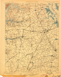 1899 USGS topographic map, Dover quadrangle, 1899U.S. Geological Survey, via The National Map, 1:125,000. U.S. Geological Survey: public domain, U.S. government work.Louvri tout kat la
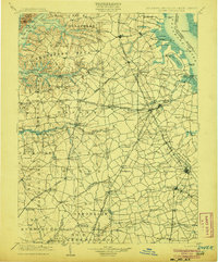 1906 USGS topographic map, Dover quadrangle, 1906U.S. Geological Survey, via The National Map, 1:125,000. U.S. Geological Survey: public domain, U.S. government work.Louvri tout kat la
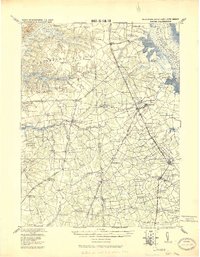 1920 USGS topographic map, Dover quadrangle, 1920U.S. Geological Survey, via The National Map, 1:125,000. U.S. Geological Survey: public domain, U.S. government work.Louvri tout kat la
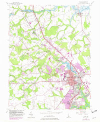 1956 USGS topographic map, Dover quadrangle, 1956U.S. Geological Survey, via The National Map, 1:24,000. U.S. Geological Survey: public domain, U.S. government work.Louvri tout kat la
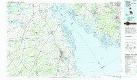 1984 USGS topographic map, Dover quadrangle, 1984U.S. Geological Survey, via The National Map, 1:100,000. U.S. Geological Survey: public domain, U.S. government work.Louvri tout kat la
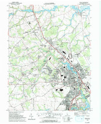 1993 USGS topographic map, Dover quadrangle, 1993U.S. Geological Survey, via The National Map, 1:24,000. U.S. Geological Survey: public domain, U.S. government work.Louvri tout kat la