Dover through time
Old maps of Dover
These maps are free to view and reuse. Pick one to open the full map at the Library of Congress or the U.S. Geological Survey.
Maps by year
- 1859 Map of Kent County, Delaware, from actual surveys
- 1885 Sanborn fire insurance map of Dover, April 1885
- 1891 Sanborn fire insurance map of Dover, 1891
- 1897 Sanborn fire insurance map of Dover, 1897
- 1899 USGS topographic map, Dover quadrangle, 1899
- 1904 Sanborn fire insurance map of Dover, September 1904
- 1906 USGS topographic map, Dover quadrangle, 1906
- 1910 Sanborn fire insurance map of Dover, 1910
- 1919 Sanborn fire insurance map of Dover, 1919
- 1920 USGS topographic map, Dover quadrangle, 1920
- 1929 Sanborn fire insurance map of Dover, August 1929
- 1950 Sanborn fire insurance map of Dover, August 1950
- 1956 USGS topographic map, Dover quadrangle, 1956
- 1984 USGS topographic map, Dover quadrangle, 1984
- 1993 USGS topographic map, Dover quadrangle, 1993
County map
 1859 Map of Kent County, Delaware, from actual surveysJ. H. French and others, via the Library of Congress. Library of Congress: public domain, free to use and reuse. Credit: Library of Congress, Geography and Map Division.Open the full map
Fire insurance maps
Sanborn maps drew every building, street by street, for fire insurance companies.
 1885 Sanborn fire insurance map of Dover, April 1885Sanborn Map Company, via the Library of Congress. Library of Congress: public domain, free to use and reuse. Credit: Library of Congress, Geography and Map Division.Open the full map
 1891 Sanborn fire insurance map of Dover, 1891Sanborn Map Company, via the Library of Congress. Library of Congress: public domain, free to use and reuse. Credit: Library of Congress, Geography and Map Division.Open the full map
 1897 Sanborn fire insurance map of Dover, 1897Sanborn Map Company, via the Library of Congress. Library of Congress: public domain, free to use and reuse. Credit: Library of Congress, Geography and Map Division.Open the full map
 1904 Sanborn fire insurance map of Dover, September 1904Sanborn Map Company, via the Library of Congress, 7 sheets. Library of Congress: public domain, free to use and reuse. Credit: Library of Congress, Geography and Map Division.Open the full map
 1910 Sanborn fire insurance map of Dover, 1910Sanborn Map Company, via the Library of Congress. Library of Congress: public domain, free to use and reuse. Credit: Library of Congress, Geography and Map Division.Open the full map
 1919 Sanborn fire insurance map of Dover, 1919Sanborn Map Company, via the Library of Congress. Library of Congress: public domain, free to use and reuse. Credit: Library of Congress, Geography and Map Division.Open the full map
- Not online yet1929 Sanborn fire insurance map of Dover, August 1929Sanborn Map Company, via the Library of Congress, 23 sheets. Library of Congress catalog record. Not scanned, so there is no image to view online.Open the full map
- Not online yet1950 Sanborn fire insurance map of Dover, August 1950Sanborn Map Company, via the Library of Congress, 24 sheets. Library of Congress catalog record. Not scanned, so there is no image to view online.Open the full map
USGS maps
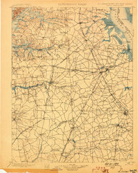 1899 USGS topographic map, Dover quadrangle, 1899U.S. Geological Survey, via The National Map, 1:125,000. U.S. Geological Survey: public domain, U.S. government work.Open the full map
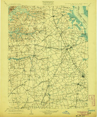 1906 USGS topographic map, Dover quadrangle, 1906U.S. Geological Survey, via The National Map, 1:125,000. U.S. Geological Survey: public domain, U.S. government work.Open the full map
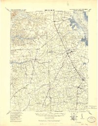 1920 USGS topographic map, Dover quadrangle, 1920U.S. Geological Survey, via The National Map, 1:125,000. U.S. Geological Survey: public domain, U.S. government work.Open the full map
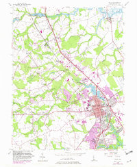 1956 USGS topographic map, Dover quadrangle, 1956U.S. Geological Survey, via The National Map, 1:24,000. U.S. Geological Survey: public domain, U.S. government work.Open the full map
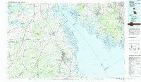 1984 USGS topographic map, Dover quadrangle, 1984U.S. Geological Survey, via The National Map, 1:100,000. U.S. Geological Survey: public domain, U.S. government work.Open the full map
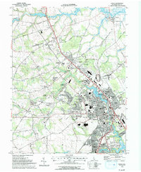 1993 USGS topographic map, Dover quadrangle, 1993U.S. Geological Survey, via The National Map, 1:24,000. U.S. Geological Survey: public domain, U.S. government work.Open the full map